The Sailing App - It's like Google Maps for Boats.
Savvy routing, departure planning, charts, weather, wind, GPS, satellite mode and more...

Over 2 Million Downloads

4.6 out of 5
Over 5,000 5 Star Reviews

RAD NAV APP
I use Savvy Navvy daily for all my inshore fishing here in south Texas. Great for current conditions, including tides and wind direction. It’s like Google maps for boaters. Plan routes, mark your fishing spots and return to the dock in one piece. Every time! Great App 5 stars.

Lifesaver!
2 weeks ago during the heatwave, we were on the Solent and the temperature fried all our instruments including the GPS plotter. Thank god we had Savvy Navvy as it worked perfectly for the entire weekend and allowed us to do everything we wanted. People say these kind of apps aren’t meant to replace the instruments on board, well I can confirm that when they instruments on board all fail, this was an absolute lifesaver. Can’t wait to test it in other countries.

Great and simple to use
I sail with friends and families and this app is a great way to illustrate “dads” boring chart work through a much more teenage friendly platform. I use both for cross reference and find it pretty accurate. Considering the price of charts it is extremely good value.
Innovative Features
To Put the Wind in Your Sails

Savvy Charts™
Whether you call them charts or a sea map we don’t mind! Either way, our designers have built Savvy Charts™ to show you essential marine information that’s easy to understand, without the clutter. View our chart coverage.


Sailing Route Planner
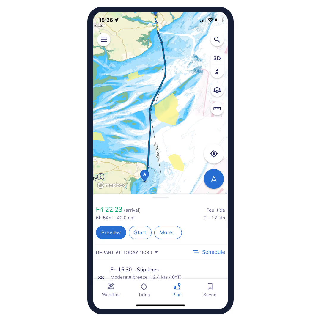
Passage planning is time-consuming but with Savvy Navvy you can plot a route to sail in seconds on any device, a great cross-check for traditional navigation. Tap the screen to drop a pin at your start and finish locations and the app will calculate the best route to sail, taking into account essential marine information and your boat settings.

Estimated Arrival Times
No one likes to be late but when it comes to sailing it can be tricky to be accurate when it comes to your arrival. With Savvy Navvy we do all the work for you. Plot a route to get an automatically predicted ETA based on wind, weather, tide and chart data. Click to share the route with your friends and family so they know you’re safe.


Tidal Streams and Tide Data
Understanding what the tide is doing is essential for sailors. That’s why we provide tidal stream data from thousand of tidal stations around the globe, in addition, sailors can use our tidal graph to easily view tidal highs and lows throughout the day. Checking the tide has never been so fun!

Global Positioning System (GPS)
Sometimes in home waters that you know well you just want to go sailing without plotting a route, we get it. That’s why Savvy Navvy has a “GPS view” which enables you to check your COG and SOG and easily calculate distances to key landmarks around you with ease.


Wind Forecast Map
Instead of using a dedicated marine weather app, you can now check the predicted wind direction and strength in the Savvy Navvy app. By using the slider you can easily view the changing wind pattern throughout the day. Read more Savvy weather models

Sailing Weather Forecast
You may be used to using a dedicated marine weather app but with Savvy Navvy you can check the weather forecast for your location by dropping a pin on the chart to instantly view the weather forecast, wind speed and direction for that area. Use the toggle to see the changing effects of the weather over the next few days.


Fuel Efficiency
Adjust your engine and cruising speed settings to enable Savvy Navvy to calculate your estimated fuel consumption. Never worry about running out of fuel again.

Schedule departure time
See at a glance the best time to depart based on your route, wind & tidal conditions, see the demo.

Explore even more cool features
Automate your Course to Steer
Get an automatic CTS and preview your route when planning a sailing trip with Savvy routing™. Our routing algorithm uses wind, weather and tide data to give you a proper passage plan with Course to Steer information.
Marinas and Anchorages
Need to know the minimum depth of a marina? Looking for moorings or water fill-up stations? Perhaps you need to know the holding for dropping anchor? Find out all you need to know for the perfect stopover with our Navily and Dockwa marina and anchorage information, available to all members.
Satellite view
Used to using Google Maps to inspect key locations for your sailing trip? Now you can do it in the Savvy navvy app! Just switch from Map to Satellite mode to take a closer look! We also have a night mode too.
Going Off-Grid - Offline Charts
Planning to sail out of range of signal? Download Savvy charts™ and weather when sailing offshore so you can keep using all the app features whilst you’re away.
Exporting Your Route
You can use your savvy passage plan by exporting the route to a GPX file that can then be uploaded to your boat chartplotter.
Support
Savvy Navvy is run by sailors for sailors. Think of us as your silent first mate, if you need us we’re here to help! Contact our team via the chatbot in the app or email us at ahoy@savvy-navvy.com
Ready to Go Sailing?
Sail Away With Us, Download Savvy Navvy Today.
The Savvy Navvy boating app is available on Android or iOS with a 14-day free trial.


